12 Best Bike Trails in Winnipeg Even Some Locals Might Not Know About

As an avid cyclist, I can’t get enough of Winnipeg’s lovely bike trails.
There’s nothing like the feeling of the wind in your hair and the sights of the city or nature around you—whether it’s cruising along the river or pedaling through lush parks. The mix of greenery and urban landscapes makes every ride a new adventure.
If you’re anything like me and always on the lookout for new trails to explore, I’ve rounded up some of the best spots to ride in Winnipeg, perfect for seasoned cyclists or those just getting started.
Here’s a list of hidden trails that’ll make your next biking adventure unforgettable!
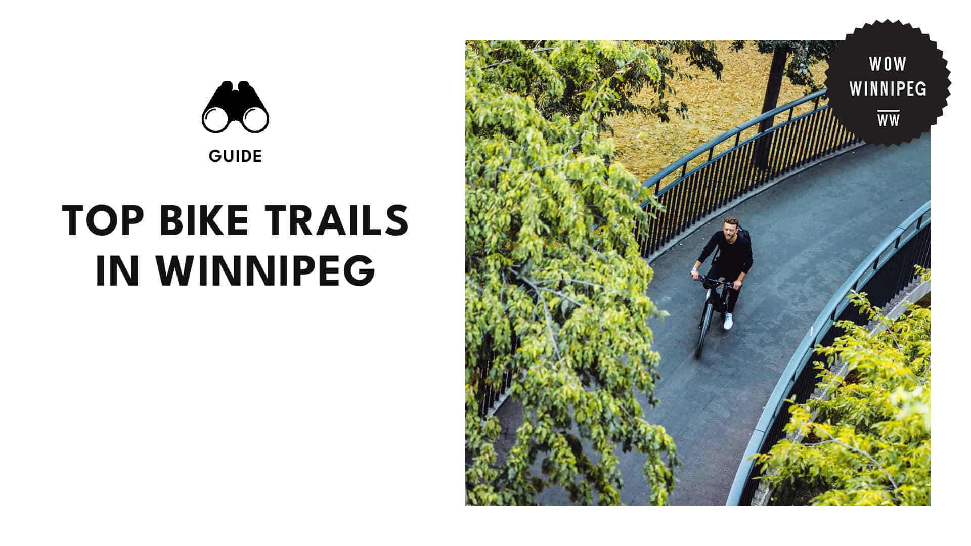
Assiniboine Park to the Forks
– Media credit: redpearlgirl/
Website: https://www.assiniboinepark.ca/
Instagram: https://www.instagram.com/assiniboine_park/
Address: 55 Pavilion Crescent
Hours: Open 24 hours
Contact: (204) 927-6000
Assiniboine Park is one of the largest in the city, filled with lush, tree-lined bike pathways that take you through peaceful nature and past beautiful attractions.
We suggest fueling up first at the Assiniboine Park Café. Grab a delicious all-day breakfast and take a moment to relax on their lovely patio before hitting the trails.
Then, head east along the north side of the Assiniboine River, making your way onto Wolseley Ave. Make sure to check out the Canora/Ethelbert back lane murals, then head to The Forks for a perfect lunch break.
Your return ride takes you south across the old train bridge, where you’ll hop onto the rapid transit bikeway. Follow the path along Sterling Lyon and take in the fresh air as you make your way through Assiniboine Forest—a beautiful final stretch!
| Pro Tip: Want to wrap up your cycling adventure in style? Check out the Assiniboine Park website to see what’s happening at the Pavilion—from live performances to community events, there’s always something fun going on! |
Winnipeg Trans Canada Trail
– Media credit: transcanadatrail
Website: https://tctrail.ca/
Instagram: https://www.instagram.com/transcanadatrail/
Address: Trans-Canada Hwy
Hours: Open 24 hours
Contact: [email protected]
The Trans Canada Trail is an absolute must-ride for cycling enthusiasts in Winnipeg. As the longest network of trails in the world, it stretches over 22,000 kilometers once complete, linking the Atlantic, Pacific, and Arctic Oceans.
It follows the Red, Assiniboine, and Seine Rivers, offering cyclists a mix of scenic parks, forests, and historic neighborhoods.
One of the things we love about the Trans Canada Trail is the variety of landscapes you’ll encounter—from the calm riverside paths to lush, wooded sections. The trail is particularly beautiful during the fall months such as September and October.
For those who like to plan ahead, the Trans Canada Trail map is a great resource to pick your start and end points.
| Pro Tip: Pack plenty of water and snacks, especially if you plan on covering longer sections of the Trans Canada Trail. You’ll definitely want to stay fueled up for the journey! |
Awasisak Mēskanow Greenway Trail
– Media credit: awasisak
Website: https://winnipegtrails.ca/trails-maps/bishop-grandin-trail-east/
Instagram: https://www.instagram.com/awasisak/
Address: Winnipeg
Hours: Open 24 hours
Contact: [email protected]
The Awasisak Mēskanow Greenway Trail, formerly known as the Bishop Grandin Greenway, is Winnipeg’s longest multi-use trail, stretching just over 12 km.
Starting at the residential community of Sage Creek in the east, the trail winds its way through various neighborhoods. As you head west, you’ll eventually reach Charleswood, making it a perfect route for long rides or connecting with other parts of the city.
As you bike, you’ll pass through lush green spaces and three beautiful retention ponds—Apakway, Eagles, and Nature’s Haven—that support local wildlife.
We like that the trail also offers helpful amenities. Examples include asphalt surfacing for about 7 km, distance markers to track your progress, and even washrooms and refreshments at key spots like St. Vital Park and St. Vital Shopping Centre.
| Pro Tip: Need a place to park before you start your adventure? St. Vital Park (190 River Rd) and St. Vital Shopping Centre (1225 St. Mary’s Rd) both offer convenient parking options, so you can easily access the trail and get going on your ride! |
Seine River Greenway
– Media credit: save.our.seine
Website: https://winnipegtrails.ca/celebrate-trails-day/seine-river-greenway/
Instagram: https://www.instagram.com/seine-river-trail/recent/
Address: 444 Adsum Dr
Hours: Mon – Fri: 6 AM – 8 PM
Sat: 9 AM – 6 PM
Sun: 11 AM – 6 PM
Contact Details: +1 877-311-4974
The Seine River Greenway Trail is one of Winnipeg’s hidden treasures, offering cyclists a beautiful loop around the scenic Seine River. Here, you’ll have plenty of places to stop and relax, whether it’s a picnic area, a playground, or even a small beach.
To get started, head toward Robin’s on Provencher, where you’ll find a gravel path that leads you into the woods.
Keep your eyes peeled for the two main trails that cut into the trees towards the Seine River—one lower down near the riverbank, and another a little higher up. Feel free to customize your ride based on your mood or skill level.
Another way to access the trail is by heading all the way to the end of Youville St.; at the end of the cul-de-sac, you’ll find another gravel trail entrance that leads you straight into the loop. From there, it’s a smooth ride along the river.
| Pro Tip: Be mindful of the weather! If the Seine River has experienced flooding, some sections of the trail, including the gravel path, might be underwater, making it tough to complete the loop. |
Harte Trail
– Media credit: hartetrail
Website: https://www.hartetrail.com/
Instagram: https://www.instagram.com/hartetrail/
Address: 21 South End Ave.
Hours: Open 24 hours
Contact Details: [email protected]
Harte Trail is one of Winnipeg’s favorite cycling and hiking spots, offering a 13.2-km out-and-back journey that’s perfect for a peaceful ride or a nature-filled walk. Part of the Trans Canada Trail, it follows an old railway bed through a narrow strip of wilderness.
Some sections of the trail are shaded by dense woods, while others open up to the sun, offering wide, exposed views of the prairie. We think the route is fairly straightforward, with the occasional intersection by one of the half-dozen streets in Charleswood.
Along the way, you’ll also pass by the Van Roon Prairie Garden, a beautiful native species garden and tree area, named in honor of long-time Charleswood residents.
The trail is incredibly well-maintained—the crushed limestone surface is perfect for cycling, providing solid footing while still feeling like a natural part of the landscape.
| Pro Tip: Need to take a break? Stop by Marj Edey Park at 4230 Ridgewood Ave, where you’ll find washrooms available to freshen up during your ride. |
Assiniboine Forest Trail
– Media credit: _arden_is_alright_
Website: https://legacy.winnipeg.ca/AssiniboineForest.stm
Instagram: https://www.instagram.com/assiniboine-forest/
Address: 2595 Roblin Blvd
Hours: Mon- Fri: 8:30 AM – 4:30 PM
Contact: 311
Assiniboine Forest is one of the largest urban nature parks in Canada—a prime spot for cyclists. It offers a network of paved trails that connect seamlessly to Assiniboine Park to the north and the Harte Trail to the south.
With 18 kilometers of well-maintained multi-use trails, this forest has something for every type of cyclist. The paths are a mix of paved, woodchip, and crushed limestone surfaces, all clearly marked with maps along the way.
As you cycle through Assiniboine Forest, you’ll encounter wooded areas and swampy spots, providing a diverse and ever-changing ride. The trails are also open year-round.
The forest is also filled with birches, wild raspberry bushes, and a variety of seasonal critters, making it a great place for wildlife spotting. Keep your eyes peeled for birds, small animals, and even the occasional white-tailed deer grazing along the trail.
| Pro Tip: We recommend bringing along some bug spray when heading into Assiniboine Forest. Little critters can be a nuisance, especially in the warmer months! |
Northeast Pioneers Greenway
– Media credit: markwilson_1982
Website: https://winnipegtrails.ca/trails-maps/northeast-pioneers-greenwaynew/
Instagram: https://www.instagram.com/northeast-pioneers-greenway/
Address: Near Winnipeg
Hours: Mon – Sun: Open 24 hours
Contact: 311
The Northeast Pioneers Greenway (NPG) is a must-visit trail for anyone looking to explore Winnipeg’s rich history and natural beauty.
This 6.9-km point-to-point trail is a rail-to-trail conversion of the former Marconi Spur rail line. Now, it serves as a popular active transportation corridor, welcoming cyclists, walkers, and nature lovers alike.
As you pedal along the trail, you’ll be surrounded by native prairie habitat. It’s a great spot for birdwatching and wildlife spotting, as the trail provides homes for all kinds of creatures, from insects to birds and even the occasional turtle.
It’s also generally considered easy, with an average ride time of about 1 hour and 15 minutes. And since it’s open year-round, it’s great to visit any time of the year, whether for cycling, snowshoeing, or simply taking in the scenery.
| Pro Tip: Need a place to park? You’ve got a few options! Try the Chalmers Community Centre (480 Chalmers Ave), Centennial Park (800 Raleigh Ave), or the Gateway Recreation Centre (1717 Gateway Rd) for convenient access to the trail. |
Churchill Drive Park to Lyndale Drive
– Media credit: wynnnc
Website: https://legacy.winnipeg.ca/Churchill.stm
Instagram: https://www.instagram.com/churchill-drive-park/
Address: Winnipeg
Hours: Open 24 hours
Contact: 311
Looking for a short but sweet ride? Churchill Drive Park offers a lovely cycling experience in the heart of Winnipeg; this easy 2-kilometer trail runs along the Red River, connecting Churchill Drive Park to Lyndale Drive.
The trail begins on a gravel path that hugs the curve of the Red River, offering stunning riverside views. As you continue westward under the Osborne Street Bridge, the path transitions to wood chips—this section is especially beautiful, with more trees.
Though the trail ends just before reaching the iconic BDI (Bridge Drive-In), it’s a great turnaround point to enjoy a refreshing treat before heading back the same way. Along the route, you’ll find plenty of shaded spots to take a break and enjoy the scenery.
If your kids want to join in on the fun, we suggest bringing them along! This trail is ideal for families or beginner cyclists looking for a quick, scenic ride.
| Pro Tip: This trail is perfect for those new to cycling. It’s short, scenic, and shaded, offering just the right mix of beauty and accessibility for a fun outing close to home. |
Bois-des-Esprits
– Media credit: gustavosouza_ca
Website: http://www.winnipegtrails.ca/trails-maps/bois-des-esprit/
Instagram: https://www.instagram.com/bois-des-esprits/
Address: 650 Shorehill Dr
Hours: Mon – Sun: Open 24 hours
Contact: 311
Bois-des-Esprits is part of the 27-km Seine River Greenway. It’s often referred to as the “heart and lungs” of the parkway system—and for good reason.
This pristine forest provides a peaceful, scenic setting for cycling; the trail itself is a good singletrack ride that’s not too intimidating.
Between the greenway and John Bruce Street, the ride is relatively smooth and free of technical challenges. However, as you continue past John Bruce Street toward the bridge, you’ll encounter some quicker sections with smaller, punchy climbs.
On the second half of the trail, as you ride through the housing area, keep an eye out for trail entrances on your right. Some of these lead to small dirt jumps, which are a fun detour for riders looking to test their skills.
| Pro Tip: Avoid this trail after heavy rain or during spring flooding, as it takes time to dry out properly. Give it a chance to recover, and you’ll be rewarded with a much better ride! |
Niakwa Trail
– Media credit: anett_harmath
Website: https://winnipegtrails.ca/trails-maps/niakwa-trail/
Instagram: https://www.instagram.com/thecityofwinnipeg/
Address: Fermor Ave
Hours: Open 24 hours
Contact: 311
The Niakwa Trail is a 4.1-kilometer pathway in Winnipeg’s south end. Named after the residential community of Niakwa, this trail is a vital corridor connecting neighborhoods, parks, and amenities.
Running along the north side of Fermor Avenue, the trail stretches between St. Anne’s Road and Niakwa Road East. As you ride, keep an eye out for King George Park, a charming little recreational area at the south end of Des Meurons.
Farther along, you’ll come across Papoose Park, a lovely strip of green space featuring a picturesque footbridge over the Seine River. We recommend pausing and enjoying the view or snapping a quick photo.
With its connections to nearby communities and parks, it’s a fantastic option for a lovely homemade-packed picnic after a quick trip through the south end of the city.
| Pro Tip: While you’re in the area, take a detour to visit the Royal Canadian Mint. This striking architectural landmark is home to a state-of-the-art manufacturing facility that produces every Canadian circulation coin! |
Sturgeon Creek Park
– Media credit: redpearlgirl
Website: https://winnipegtrails.ca/trails-maps/sturgeon-creek-pathway/
Instagram: https://www.instagram.com/sturgeon-creek-greenway/
Address: 596 Cavalier Dr
Hours: Open 24 hours
Contact: 311
Sturgeon Creek Park is a fantastic spot for a relaxing bike ride, offering 4 kilometers of scenic pathways along the banks of Sturgeon Creek.
The trail itself runs in a south-to-north direction, connecting Woodhaven Park to Saskatchewan Avenue. The easy-going, level path offers lovely views of the creek, and the openness provides a refreshing vibe as you pedal along.
We love that the pathway is stroller- and wheelchair-friendly, with good parking options.
A unique feature of this trail is its underpass beneath Portage Avenue. You’ll need to hop onto the sidewalk along Hamilton Avenue to connect with the trail at Silver Avenue, but the seamless connectivity makes this route a joy to ride.
| Pro Tip: Be mindful of the trail surface changes! Asphalt surfacing keeps things smooth, but crushed limestone sections between Woodhaven & Portage Avenue and Hamilton & Saskatchewan Avenue offer a more rustic feel. |
Bunn’s Creek Centennial Park
– Media credit: victorvan1
Website: https://legacy.winnipeg.ca/publicworks/parks/bunns-creek.stm
Instagram: https://www.instagram.com/bunns-creek-centennial-park/
Address: 365 McIvor Ave
Hours: Mon – Sun: 7 AM – 10 PM
Contact: 311
Bunn’s Creek Centennial Park is a beautiful 6.4-km out-and-back trail near East Saint Paul that’s perfect for a relaxing bike ride or a leisurely stroll. Generally considered easy, it’s a great option for cyclists of all skill levels.
The path is especially enjoyable from March through November. However, the trail can get a little narrow in spots and is prone to flooding in the spring, so be mindful of trail conditions before heading out.
One of the best features of this trail is its year-round accessibility. The city plows the pathway in the winter, making it a great spot to explore even in colder months.
The trail is also conveniently divided into sections, so you can enjoy a shorter ride or stop halfway at Bunn’s Creek Park to relax and soak in the scenery.
| Pro Tip: If 6 km doesn’t feel like enough for you, we suggest taking advantage of the connection to the Northeast Pioneers Trail at Gateway. Doing so will extend your ride, and you can explore even more of Winnipeg’s beautiful trail system! |